 The twin
01
Explorable 3D course
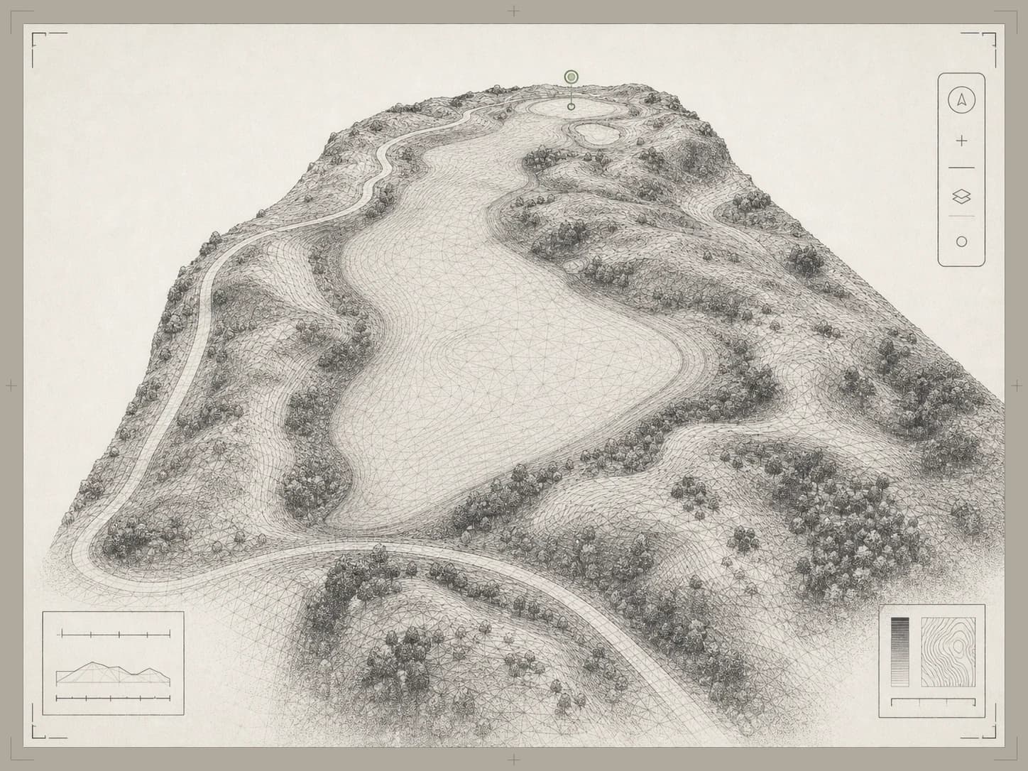
Every hole as a textured 3D model you can orbit, fly through, and measure in a browser. It is the shared reference for staff, golfers, and guests.
What a golf course digital twin isWe fly your course with a mapping drone and turn it into an explorable 3D model in the browser. Your superintendent tracks issues and drainage on it, your GM plans projects on it, your golfers preview every hole, and your website shows it off.
This is a real hole from a Course Correct twin. It is shown in the golfer view: the AI caddie is answering from the hole’s own terrain, with tours, per-tee yardages and the green guide beside it.
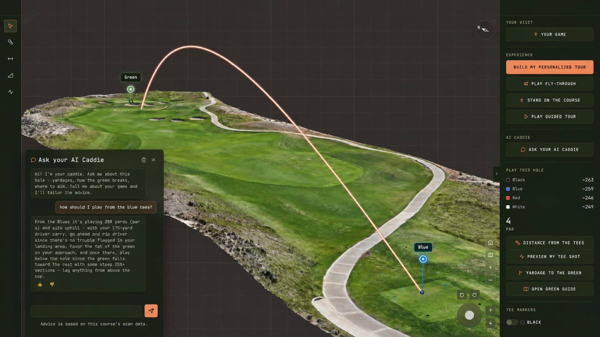
Screenshot of the Course Correct viewer · drone photogrammetry · indicative, not survey-grade
The twin puts what a club knows about its course in one place, measured from the real ground.
The wet spot behind 7 green, described three different ways.
Staff pin an issue on the 3D course with a photo, priority, assignee, and due date, then track it on one board.
Course issue trackingWalk it, guess it, argue about it.
Slope classes, 0.5 m contours, and water flow paths for your staff, drawn from your course's elevation data.
Slope and drainage mappingOne number to the middle, the same for every player.
Per-tee yardages, plays-like distances to the green, green reads, and an AI caddie that answers from the hole's own data.
The AI caddiePlays once, the same way, for everyone.
Visitors ride a hole's guided tour on your website, then take the controls and look around. The full course is one link away, and you see which holes hold their attention.
Interactive 3D course toursEvery capture produces the same set of layers. Staff work from terrain and drainage, golfers from the green guides, and everyone from the twin itself.
The twinEvery hole as a textured 3D model you can orbit, fly through, and measure in a browser. It is the shared reference for staff, golfers, and guests.
What a golf course digital twin is Terrain
Slope classes, elevation bands, and 0.5 m contours draped over each hole, so questions about grade get a measured answer.
Slope and drainage mapping Green guides
Contours, fall lines, and a slope reading wherever you tap. Staff publish the day's pin; golfers see the break to it.
Green guides Drainage
Flow paths from minor runs to main channels, plus a wet-areas layer on the aerial map. For staff, from the same capture.
Finding drainage problemsThe same capture answers different questions depending on who opens it. The layers are all there from day one.
Issues pinned where they are, drainage and slope mapped from drone elevation data, and measuring tools your crew can use in a browser.
SuperintendentsFor GMs and ownersMeasure renovation ideas on the real ground, see everything open across the course, and put an explorable course on your website.
GMs and ownersFor resorts and destination coursesAn explorable 3D twin of the course on your website and clubhouse screens, with yardages, green reads and an AI caddie that knows the terrain. Your agronomy team runs the course on the same model.
ResortsHole tours, per-tee yardages, plays-like distances to the green, green reads, and an AI caddie. No app, no account.
A guided tour of each hole, per-tee yardages, and a tee-shot preview based on how far they carry it.
Front, center, and back yardages with plays-like distance, and an AI caddie that answers from the hole's own terrain.
Slope arrows, fall lines, and the break to the day's pin, on screen or printed.
A mapping drone captures the course hole by hole, early in the day. One crew, scheduled with your superintendent, and out of the way before play gets busy.
The imagery becomes one explorable model of the property, with elevation, slope, drainage, and per-green contours derived from it.
Staff sign in to track issues and measure. Golfers open a link to plan their round. We set up the embed for your website.
Nothing to install · runs in a standard browser · embeds in your existing website with one snippet
How we capture a courseEvery use on this page starts from the same capture of your actual ground. Nobody is working from an illustration, an old plan, or memory.
Drone photogrammetry gives working detail for maintenance, planning and play. It is indicative, not survey-grade, and it is not a licensed survey. Engineered work should be checked against one.
Slope and contours from centimeter-scale drone elevation data
Slope and fall line at every yard of every green
Runs in the browser, for staff, golfers, and your website
Every fairway and green is modeled from drone imagery of your course, so what staff measure and golfers study is the ground as it is today.
Staff, golfers, and website visitors open the same twin with different tools. Drainage, issues, and earthwork stay behind staff sign-in.
It opens from a link in a standard browser and embeds in your existing website. No app and no plugin.
The twin is a model you can measure. Staff and golfers get tools on the same ground, each for their own questions.
Point to point across the hole, as a straight 3D line or as plan distance on the level.
Pick two points for the grade between them in percent and degrees, or turn on the slope layer for the whole hole.
Draw a line and get the elevation profile along it: across a fairway, through a bunker face, up to a green.
Outline a stockpile or a grading area for cut, fill, net volume, and approximate tonnage. For course staff.
Front, center, and back of the green from any spot, with the elevation change and a plays-like number.
On the twin: which holes visitors explore, which tours they finish, and where they came from. Anonymous and collected without cookies, on a dashboard for your admins.
Distance, slope and cross-section tools run in a desktop browser · cut and fill is a staff tool · indicative, not survey-grade
Renovation planning on the twinWe would rather show you the product and the process than make claims about them.
The flight, the processing, what 0.5 m contours and a one-yard green grid mean, and what the model cannot tell you.
The methodCourse Correct is an Elias Immersive company. Who runs it, how we work, and how to reach us.
About usA demo runs on a live course twin in the browser, with your team asking the questions. There is no slide deck.
Book a demoPin issues on the course and track them on a shared board, turn on slope, elevation, contour, and drainage layers, and measure distance, grade, and cross-sections, with cut and fill for earthwork. Staff tools sit behind sign-in, with roles you control.
A 3D tour of every hole, per-tee yardages, plays-like distances to the green, a tee-shot preview, green guides with the day's pin, and an AI caddie that answers from the hole's own data. It opens from a link, with no account and no app.
Yes. We set up a single iframe that drops into any page of your existing site, on any CMS. It shows a hole as a guided tour the visitor can take over, with the full course one link away. A full-screen showcase runs the course on a clubhouse screen. On the twin, an engagement dashboard shows your admins which holes visitors explore, which tours they finish, and where they came from. That measurement is anonymous and collected without cookies.
Thirty minutes on a live course twin in the browser, with your team: a few minutes on your course and goals, then the staff tools, the golfer experience, and the embed running inside a real webpage. You also get straight answers on what your own course would cost and how long it would take. Bring your superintendent and your general manager if you can.
The flying is usually a morning or two, planned around your tee sheet and scheduled with your superintendent. The drone stays high and quiet, and if a hole needs to be clear for a few minutes we arrange it ahead of time. Processing takes days, not weeks.
Drone photogrammetry: overlapping aerial photos from a mapping drone, processed into a 3D model and an elevation model with 0.5 m contours and a one-yard green grid. It records the surface the camera sees, so under tree canopy it shows the trees and not the ground beneath them.
The terrain comes from centimeter-scale drone elevation data, with slope and contours computed on a half-meter grid and greens on a one-yard grid. That is working detail for maintenance, planning, and play. It is indicative, not survey-grade, and it is not a licensed survey, so engineered work should still be checked against one.
A flight window agreed with your superintendent, usually early in the day, and a contact for your website if you want the tour embedded. After that, your staff sign in with their own accounts.
Only your staff. Issues, drainage, and the earthwork tool sit behind sign-in, and your course admins decide who is on the team. Golfers and website visitors get the golfer view.
30 minutes, on a live twin, with your team. We'll show the staff tools, the golfer experience and the website embed, then map out what your course would involve.